Model Policies
Model policies for activity friendly routes to everyday destinations
This resource is designed to help communities pass policies that can help get more Americans physically active—specifically by creating connected, healthy communities where people can safely and easily walk, bike, roll, or move actively with assistive devices to reach nearby key destinations. To learn more about these policy levers across the three goals of transportation, land use, and human-scale built form, explore the four tabs below. Each of the three policy sections features model policy language from real-life communities across the United States to help guide implementation.
 Active People, Healthy NationSM is a national initiative led by the Centers for Disease Control and Prevention to help 27 million Americans become more physically active by 2027. This initiative includes seven strategies to increase physical activity, the first and foremost of which is promoting activity-friendly routes to everyday destinations. This strategy works to create connected, healthy communities where people can safely and easily walk, bike, roll, or move actively with assistive devices to reach nearby key destinations. Realizing this transformative vision for compact, activity-friendly communities typically begins with a policy commitment to consistently plan, design, and invest in healthier places.
This resource highlights fifteen policy levers across three areas to help communities realize this vision of activity-friendly routes to everyday destinations. Specifically, this resource is designed to support elected officials, policymakers, and advocates in:
- Identifying needed policy changes to create healthy, equitable communities;
- Understanding why each of these policy changes is important and how they can catalyze changes in the built environment; and
- Finding examples of model policy language from communities nationwide.
Wherever applicable, this resource highlights the role these policy levers can play in alleviating health disparities. Systemic inequities are deeply rooted in our built environment due to generations of discriminatory decision-making—Black and Indigenous communities and people of color in particular are disproportionately exposed to dangerous high-speed roads. Low-income communities experience underinvestment in infrastructure to support physical activity. As a result, a successful activity-friendly routes to everyday destinations initiative must work deliberately and proactively to overcome rather than perpetuate systemic disparities by race, ethnicity, and income, as well as related disparities by age, ability, and car ownership, to ensure the benefits are equitably distributed to those who stand to gain the most.
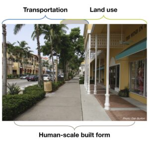
This resource organizes recommended policy levers under three goals, two of which correspond to transportation and land use. The third goal—human-scale built form—lays at the physical nexus of the other two goals. Specifically, this goal addresses policy levers that impact the space where building frontages meet the edge of the street, typically the sidewalk where one exists.
Go back to top >>Goal 1. Transportation prioritizes the health and safety of people walking, biking, rolling, and moving actively
1-1. Embed Complete Streets in routine project development
1-2. Require private development to support activity-friendly routes
1-3. Establish equitable project selection criteria
1-4. Create inclusive oversight
1-5. Measure what matters
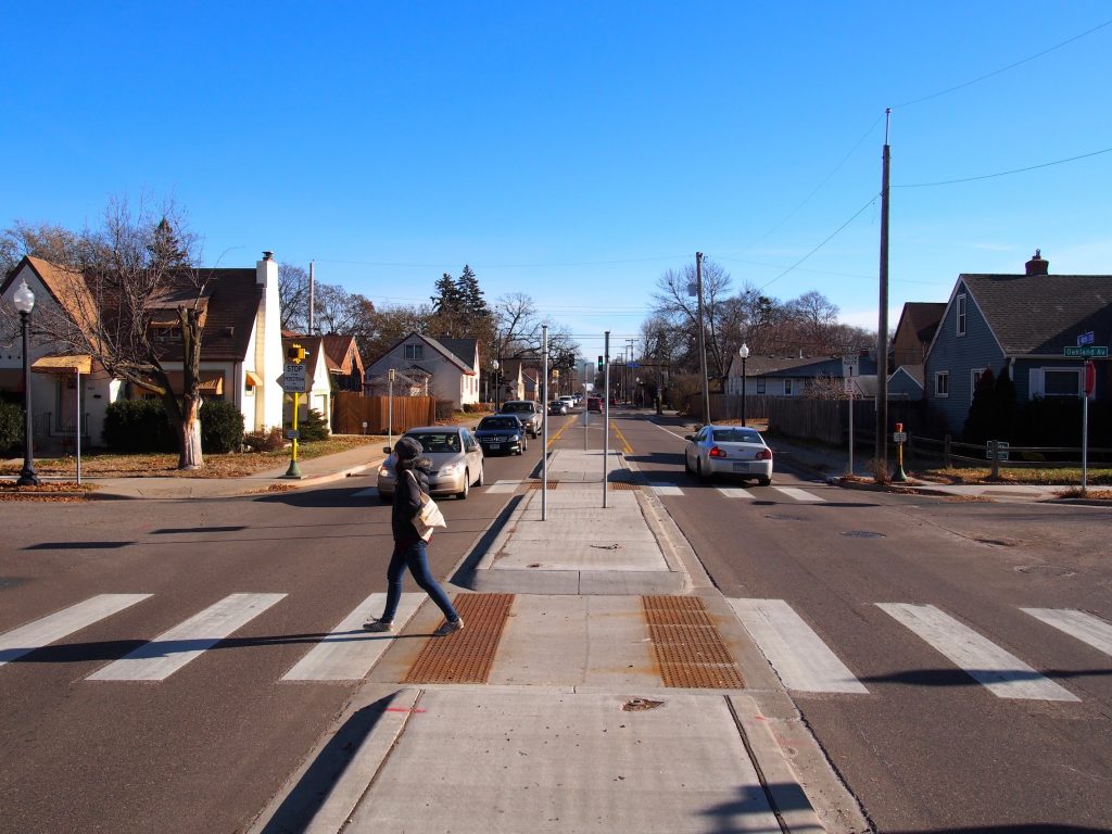
1-6. Design for safety over speed
A critical aspect of an activity-friendly routes to everyday destinations approach entails designing streets to balance the safety and needs of all people who use them, including people walking, biking, or moving actively using an assistive device, as well as people driving or riding public transit. By funding, designing, and operating the transportation network in this manner as a matter of routine, communities can gradually build complete active transportation networks that allow people using all modes to safely, comfortably, and reliably reach key destinations.
Complete Streets is one useful, comprehensive policy tool that helps a community commit to balancing all users and all modes in every aspect of transportation decision-making as part of a broader initiative to build activity-friendly routes to everyday destinations. Furthermore, Complete Streets provide a structure that enables a community to systematically prioritize equitable implementation that supports vulnerable and historically underinvested communities.
The policy levers below are derived from the National Complete Streets Coalition’s Elements of a Complete Streets Policy, a framework that the Coalition uses to evaluate newly adopted policies each year. The policy levers highlighted below are the elements most critical to support equitable activity-friendly routes to everyday destinations. We recommend you consult the Elements for additional guidance to draft and adopt strong, accountable Complete Streets policies.
Policy lever 1-1. Embed Complete Streets in routine project development
To work toward creating a complete network of activity-friendly routes to everyday destinations that enable people to safely travel wherever they need to go, Complete Streets needs to be a core part of routine, everyday decision-making. Rather than treating activity-friendly routes or Complete Streets as an “opt in” process that only applies to specialty projects, this approach should be embedded in each and every project, unless specifically determined otherwise.
There are two components to embed Complete Streets in routine project development: a) requiring all projects and phases to follow a Complete Streets approach, and b) providing a clear, accountable process for granting exemptions where appropriate.
Policy language in Little Rock, Arkansas requires all types of projects, including routine maintenance and repavement, to comply with Complete Streets. This allows the city to make transformative improvements that support walking, biking, and moving actively at relatively low incremental cost when streets are already being resurfaced, rather than simply putting the street back the way it was before.
Except as provided in Section 5 below, the City will apply this complete streets policy to all street projects for public streets, regardless of funding source, including those involving new construction, reconstruction, retrofit, repaving, rehabilitation, and change in the allocation of pavement space on an existing street. The exceptions will allow the City to remain flexible to the unique circumstances of different streets so that sound engineering and planning judgment will produce context-sensitive designs.
Read the full policy here.
Neptune Beach, Florida’s policy language provides clear guidance about when it is appropriate to formally exempt projects from complying with a Complete Streets approach. These exemptions require specific justification and documentation, and they must follow a clear process for approval, including a public review period that allows the community to weigh in before granting an exemption. This clear, codified language for both the exemption process and the exemption criteria is extremely important, because policies with vague exemption criteria can create major loopholes that allow projects to easily bypass a Complete Streets approach, which many times results in dangerous gaps in the sidewalk and bikeway networks.
1. A specific category of user may be excluded from the requirements of Section B of this Policy only if one or more of the following exceptions apply:
a. Use of the roadway is prohibited by law for the category of user (e.g., pedestrians on an interstate freeway, vehicles on a pedestrian mall). In this case, efforts shall be made to accommodate the excluded category of user on a parallel route; or
b. There is an absence of both a current and future need to accommodate the category of user (absence of future need may be shown via demographic, school, employment, and public transportation route data that demonstrate, for example, a low likelihood of bicycle, pedestrian, or transit activity in an area over the next 20 years); or
c. The cost would be excessively disproportionate to the current need or future need over the next 20 years.
2. An exception shall be granted only if:
a. a request for an exception is submitted in writing, with supporting documentation, and made publicly available with a minimum of 30 days allowed for public input; and
b. the exception is approved in writing by City Council and the written approval is made publicly available.
Read the full policy here.
go back to Transportation top menu >>
Policy lever 1-2. Require private development to support activity-friendly routes
In many communities, private developers play a major role in building or rebuilding key destinations, including housing complexes, commercial job centers, and more. Holding private developers accountable to comply with Complete Streets is an important policy lever, particularly to ensure continuity of the sidewalk network. Too often, jurisdictions are hesitant to place any requirements or restrictions on private development, for fear of deterring investment in their communities. However, when private developers are exempt from complying with Complete Streets, the result is often a patchwork active transportation network where sidewalks stop and start without warning, making it difficult or even impossible to safely reach key destinations on foot or especially using a mobility-assistive device.
Plymouth, Indiana’s policy language includes an unambiguous requirement that both public and private projects support the active transportation network by adhering to the Complete Streets policy. The policy also requires Plymouth to form partnerships with other organizations and jurisdictions, to ensure the active transportation network provides safe, complete connections to key destinations, even across municipal borders.
b. All facilities in the public right-of-way, publicly or privately funded, shall adhere to this Complete Streets Policy.
c. The City shall form partnerships with other organizations to further Complete Streets principles and ensure infrastructure extends when necessary beyond the City’s borders. These agencies include, but are not limited to Marshall County, the Indiana Department of Transportation (INDOT), the Michiana Area Council of Governments (MACOG), Marshall County Health Department, and the Plymouth Community School Corporation.
Read the full policy here.
go back to Transportation top menu >>
Policy lever 1-3. Establish equitable project selection criteria
In many communities, decisions about where and how to invest funds in transportation are made informally, based on political will or based on “squeaky wheel” complaints from residents. However, the result of this informal process for prioritizing projects often exacerbates existing disparities in the built environment: wealthier, whiter communities with expectations of political responsiveness continue to receive investment in infrastructure to support active transportation, while lower-income communities of color who have been neglected by elected leaders and transportation decision-makers continue to be marginalized.
To ensure activity-friendly routes to everyday destinations are implemented equitably, and to ensure investments in safer, healthier communities are made where they are needed most, communities should adopt a formal project selection criteria. These criteria can be used to grade proposed projects according to key metrics such as health, safety, and proximity to key destinations. In addition, these criteria can explicitly prioritize neighborhoods that have experienced underinvestment, neighborhoods with higher than average rates of chronic disease, neighborhoods with lower than average car ownership, and neighborhoods with a high share of vulnerable users.
Complete Streets policies do not usually establish these equitable project selection criteria within the codified policy language; rather, strong policies typically require a community to develop and adopt such criteria within a specified time period as a next step to implement the policy. For example, Milwaukee, Wisconsin’s policy commits to explicitly prioritize “equitable investment in underserved communities” where infrastructure to support walking, biking, and moving actively are lacking, as well as to prioritize investments based on health and safety data.
6. The Department of Public Works shall prioritize universal and equitable investment in underserved communities throughout the City which lack existing infrastructure that encourages walking, biking, and transit trips, as well as areas where data indicate crash risk and health disparities.
Read the full policy here.
go back to Transportation top menu >>
Policy lever 1-4. Create inclusive oversight
When a community adopts a policy committing to Complete Streets, creating or appointing a committee to oversee implementation is an important next step to ensure that commitment turns into action. An oversight committee empowered to make binding decisions can guarantee that all of the various policy and practice changes necessary for the success of this initiative move forward in a timely, coordinated fashion. This is particularly important for activity-friendly routes to everyday destinations, where collaboration happens across sectors, including transportation, land use, and public health.
To ensure equitable implementation of Complete Streets, this committee’s membership should include both the various departments and organizations collaborating on this initiative, as well as representatives from the vulnerable communities this initiative will prioritize, such as people living with disabilities, low-income families, people who do not have access to a car, or Black, Latino/a/x, or Native communities. Ensuring these groups are represented at the table can support more equitable implementation of activity-friendly routes to everyday destinations, by creating an opportunity for these communities to directly contribute to the decision-making process.
Importantly, this oversight committee should have the authority to make binding decisions, rather than non-binding recommendations. For example, the policy excerpt below from Tucson, Arizona ensures its Coordinating Council’s work translates to “accountability, communication, and action” by requiring senior staff from key departments to participate in meetings. In addition, Phoenix’s policy establishes a Council inclusive of “communities of color, older adults, youth, low-income communities, and people with disabilities.”
As a critical accountability measure, the City shall also establish a Complete Streets Coordinating Council to work in tandem with the Complete Streets Technical Review Committee. The Complete Streets Coordinating Council . . . shall consist of diverse stakeholders, including Mayor and Council appointees, and representatives from different sectors, industries, and issue areas (such as transportation, health, environment, environmental justice, social equity, public art, economic development, business, and construction), as well as from advocacy groups and organizations working with communities/populations prioritized through this Policy, such as communities of color, older adults, youth, low-income communities, and people with disabilities. To the extent possible, the Coordinating Council shall provide a holistic representation of Tucson’s diversity and, if possible, include representatives from these communities/populations themselves. Senior level staff from Tucson Department of Transportation and other appropriate City departments will participate in Coordinating Council meetings to ensure accountability, communication, and action.
Read the full policy here.
go back to Transportation top menu >>
Policy lever 1-5. Measure what matters
As the old adage goes, “What gets measured gets done.” In a traditional transportation planning approach, the sole and most important metric—level of service—measures delay for vehicles due to congestion or waiting at intersections. When this is the only gauge of a roadway’s “success,” the result is typically wider and wider roads. In addition, projects that support activity-friendly routes to everyday destinations tend to allocate more space to people walking, biking, and moving actively or provide more time to cross the street, typically undermining level of service. Often, this can prevent these projects from moving forward to implementation.
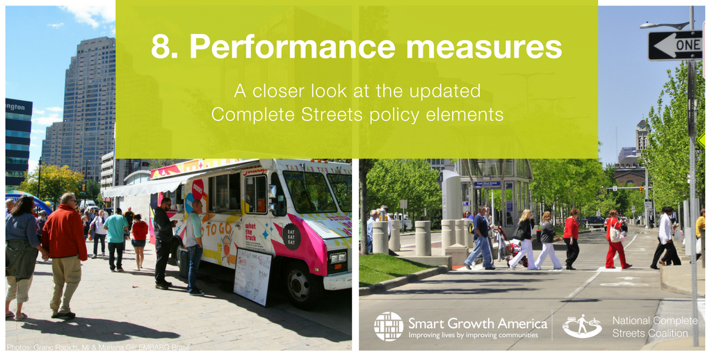
The strongest, effective Complete Streets initiatives begin by setting clear goals and establishing performance measures to evaluate achievement of those goals on a regular, recurring basis. For example, a goal of safety might be measured by crash and injury reductions; a goal of health measured by increased share of active transportation trips; or a goal of connectivity by percentage of key destinations within a quarter mile of the active transportation network. Establishing performance measures that correspond to your goals is essential to demonstrate success and to generate support and momentum for continued investment in activity-friendly routes.
Another critical aspect of measuring what matters requires embedding equity in performance measures: by disaggregating these data by race, income, car ownership, income, age, or ability depending on who is most vulnerable in your community, a jurisdiction can ensure that the benefits of activity-friendly routes are distributed fairly, and that these benefits work toward alleviating disparities rather than exacerbating them. Some jurisdictions have also embedded equity in performance measurement by evaluating the implementation process itself. For example, jurisdictions might compare the location of Complete Streets improvements by neighborhood income level to ensure investments are being distributed fairly to the places where people stand to benefit the most. Another approach to embed equity in performance measurement is to track the demographics of people reached through community engagement to identify gaps in outreach and ensure the engagement process is representative of the whole community as well as inclusive of those most vulnerable.
Baltimore, Maryland’s policy models a clear, detailed approach to embed equity in performance measurement, as well as establish clear metrics with available data sources, as shown in the excerpt below.
§ 40-47. PERFORMANCE MEASURES.
(A) IN GENERAL.
PERFORMANCE MEASURES WILL BE ESTABLISHED USING AVAILABLE DATA.
(B) CRASH DATA.
(1) IN GENERAL.
THE ANNUAL REPORT MUST MEASURE YEAR-OVER-YEAR CHANGES IN CRASH DATA FOR ALL MODES OF TRAVEL AS MEASURED BY:
(I) THE “MARYLAND STATEWIDE VEHICLE CRASHES DATA” COLLECTED BY THE MARYLAND STATE POLICE;
(II) THE “FATALITY ANALYSIS REPORTING SYSTEM” DATA COLLECTED BY THE NATIONAL HIGHWAY TRAFFIC SAFETY ADMINISTRATION; OR
(III) OTHER SIMILAR DATA.
(2) SEPARATE REPORTING BY CATEGORY.
CRASH DATA FOR ALL MODES OF TRAVEL MUST BE SEPARATELY REPORTED BY THE FOLLOWING CATEGORIES:
(I) ALL CRASHES;
(II) INJURY CRASHES; AND
(III) FATAL CRASHES.
(C) TRANSIT ON-TIME PERFORMANCE.
THE ANNUAL REPORT MUST MEASURE YEAR-OVER-YEAR CHANGE IN TRANSIT ON-TIME PERFORMANCE, AS MEASURED BY:
(1) THE PERFORMANCE DATA COLLECTED BY THE MARYLAND TRANSIT ADMINISTRATION AND PUBLISHED IN THE MARYLAND DEPARTMENT OF TRANSPORTATION’S ANNUAL ATTAINMENT REPORT; OR
(2) OTHER SIMILAR DATA COLLECTED BY THE MARYLAND TRANSIT ADMINISTRATION OR THE TRANSPORTATION DEPARTMENT.
(D) COMMUTE TIMES.
THE ANNUAL REPORT MUST MEASURE COMMUTE TIMES FOR ALL MODES OF TRAVEL, AS MEASURED BY THE TRAVEL-TIME-TO-WORK DATA REPORTED IN THE AMERICAN COMMUNITIES SURVEY’S “COMMUTING (JOURNEY TO WORK)”.
(E) MODAL SHARE.
THE ANNUAL REPORT MUST MEASURE MODAL SHARE, AS MEASURED BY THE MEANS-OF- TRANSPORTATION DATA REPORTED IN THE AMERICAN COMMUNITIES SURVEY’S “COMMUTING (JOURNEY TO WORK)”.
. . .
§ 40-48. EQUITY LENS.
(A) SEPARATE REPORTING BY GEOGRAPHIC SUBUNIT.
IN PREPARING THE ANNUAL REPORT, THE DEPARTMENT MUST SEPARATELY REPORT DATA BY GEOGRAPHIC SUBUNIT (E.G., CENSUS TRACT, TRAFFIC ANALYSIS ZONE, OR THE LIKE).
(B) SEPARATE REPORTING BY RACE, INCOME, AND VEHICLE ACCESS.
THE ANNUAL REPORT MUST SEPARATELY REPORT DATA INTO THE FOLLOWING CATEGORIES:
(1) POPULATIONS THAT ARE ABOVE AND BELOW THE MEDIAN NUMBER OF PERSONS OF COLOR FOR BALTIMORE CITY.
(2) POPULATIONS ABOVE AND BELOW 50% NO VEHICLE ACCESS.
(3) POPULATIONS WITH A MEDIAN INCOME ABOVE AND BELOW THE MEDIAN HOUSEHOLD INCOME FOR BALTIMORE CITY.
Read the full policy here.
go back to Transportation top menu >>
Policy lever 1-6. Design for safety over speed
A traditional transportation planning approach prioritizes free flow of vehicle traffic above all else, as measured through level of service, with disastrous results for safety: this approach produces wide, overbuilt roads designed exclusively for cars, resulting in dangerously high speeds. Creating activity-friendly routes to everyday destinations requires a paradigm shift to prioritize the safety of all people using the street over high speeds for people in cars. As a result, policies to support activity-friendly routes must include the adoption or revision of design guidelines that value safety over speed to protect people walking, biking, and moving actively.
In this respect, Missoula, Montana’s policy language stands out. Not only does this policy formally adopt “best and latest” design guidance by name, the policy also commits to prioritize safety over speed in situations where a traditional approach commonly fails to do so. For example, the excerpt below references “turn radii” which pertains to the width and angle of intersections. In a traditional transportation planning approach, turn radii would be designed generously wide, to allow a large vehicle to turn without infringing on the adjacent lane; however, this overbuilt design allows people driving personal vehicles to easily turn without slowing down, resulting in dangerous—potentially deadly—situations for people crossing the street. By committing to prioritize a safer, human scale in design, Missoula’s policy sets an important precedent for accepting the trade-offs that come with narrowing turn radii: improved safety for all, even if it means larger vehicles may occasionally infringe on adjacent lanes while turning.
A. The City shall use the best and latest design guidance, standards, and recommendations
available to maximize design flexibility and innovation, and always be aware that design solutions
should balance user and modal needs. This includes a shift toward designing at the human scale
for the needs and comfort of all people and travelers, in considering issues such as street design
and width, desired operating speed, turn radii, hierarchy of streets, and connectivity. Design
criteria shall not be purely prescriptive but shall be based on the thoughtful application of
engineering, architectural, and urban design principles. These materials include, but are not
limited to:
• The United States Department of Transportation Policy Statement on Bicycle and Pedestrian Accommodation Regulations and Recommendations
• The United States Department of Transportation Federal Highway Administration’s Manual of Uniform Traffic Control Devices (MUTCD)
• The United States Department of Transportation Federal Highway Administration Traffic Monitoring Guide
• The National Association of City Transportation Officials (NACTO) Urban Street Design Guide
• The National Association of City Transportation Officials (NACTO) Urban Bikeway Design Guide
• The National Association of City Transportation Officials (NACTO) Transit Street Design Guide
• The American Association of State Highway and Transportation Official’s (AASHTO) Policy on Geometric Design of Highways and Streets
• The American Association of State Highway and Transportation Official’s (AASHTO) Guide for Planning, Designing and Operating Pedestrian Facilities
• ITE Designing Walkable Urban Thoroughfares: A Context Sensitive Approach
• City of Missoula Subdivision Regulations
• Missoula Municipal Code Title 12: Streets, Sidewalks, and Public Places
• City of Missoula Sidewalk Master Plan
• City of Missoula Urban Forest Management Master Plan
• City of Missoula Landscape and Public Facilities Design Manual
Read the full policy here.
Goal 2. Land use brings a variety of destinations closer together within a short walking, biking, or rolling distance
2-1. Stop building seas of parking that separate destinations
2-2. Create urban growth boundaries to reduce sprawl
2-3. Provide density bonuses aligned with community development goals
2-4. Allow accessory dwelling units
2-5. Upzone from single-family to multi-family residences
Land use and transportation are inextricably linked. Decision-makers can bring a variety of everyday destinations closer together, including homes, schools, parks, grocery stores, jobs, hospitals, and more by establishing standards and guidance across a range of policies. Denser, compact development with community amenities in close proximity makes it much easier and more convenient to walk, bike, or move actively using assistive devices to reach these places as part everyday life, resulting in more active communities.
Conversely, many communities have land-use policies in place that make sprawling, spaced-out development the only option. When destinations are separated from one another (such as keeping homes apart from jobs, shops, and other commercial places), and when they are far apart (such as separating them with seas of parking), it becomes much more difficult to reach destinations without a car. Those who drive miss out on key opportunities for physical activity by sitting in their car rather than walking, biking, or moving actively to run errands, commute, and get around. Those who cannot afford a personal vehicle must rely on public transit if it exists or walk, bike, or navigate inconveniently long distances to get where they need to go.
The policy levers featured below are tools to help communities shift away from car-oriented land use patterns toward denser, more compact places that support active mobility. While each of these tools is highly contextual and will look slightly different in every community, the model language provided below will serve as a useful starting point to get policy-makers thinking about how these tools might be applied in their own communities.
Policy lever 2-1: Stop building seas of parking that separate destinations
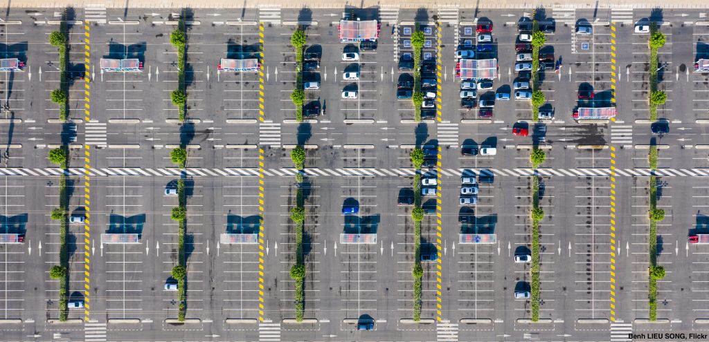
In many communities, land owners and developers are required to provide a specific minimum amount of off-street parking which is often excessive. These rules, called parking minimums, encourage car trips to reach destinations while making other modes of travel less convenient by physically spreading out and separating housing, businesses, and other everyday destinations with seas of underused parking spaces. Parking minimums can also raise the cost of housing and commercial space, as developers recoup the cost of parking they were required to build, making communities less affordable.
Reducing or eliminating parking minimums allows destinations to come closer together, encourages more activity-friendly developments, and mitigates housing costs. It reduces the time and distance needed for active travel and transit trips, making it more convenient for people to walk, bike, or move actively using assistive devices to reach key destinations. This is particularly important for people who cannot afford or cannot operate a personal vehicle, and who may rely on public transit or active transportation to get around.
Sandpoint, Idaho’s city code exempts much of the downtown core from residential and commercial parking minimums. Adopted in 2009, this change coincided with new compact development and growth within the exempt district. In 2019, the city’s director of planning provided a retrospective in which he reported that the decision to adopt the policy was initially contentious, but the change enabled millions of dollars worth of development, including rehabbing buildings and expanding local small businesses, previously not possible due to parking minimums.
F. Exemptions: Buildings within the boundaries of First Avenue, Cedar Street, Fifth Avenue and Pine Street plus one-half (1/2) block extending outward are exempt from the parking minimum requirements of this chapter.
G. Exempted Non-Residential Use Boundaries: Non-residential uses within the following boundaries are exempt from the parking minimum requirements of this chapter: Beginning at the intersection of Short Ave and Poplar St; thence East to the intersection of Poplar St and Third Ave; thence South to the intersection of Alder St and Third Ave; thence East to the high water mark of Sand Creek; thence Southerly along the artificial high water mark of Sand Creek (defined as 2,066.4′ using the NAVD88 vertical datum or 2062.5′ using the NGVD29 vertical datum) to its intersection with Lake St; thence West to the intersection of Lake St and Euclid Ave; thence West one-half block; thence North to the intersection of Sixth Ave and Alder St; thence East to the intersection of Alder St and Short Ave; thence north to the point of beginning.
Read the full policy here.
go back to Land Use top menu >>
Policy lever 2-2. Create urban growth boundaries to reduce sprawl
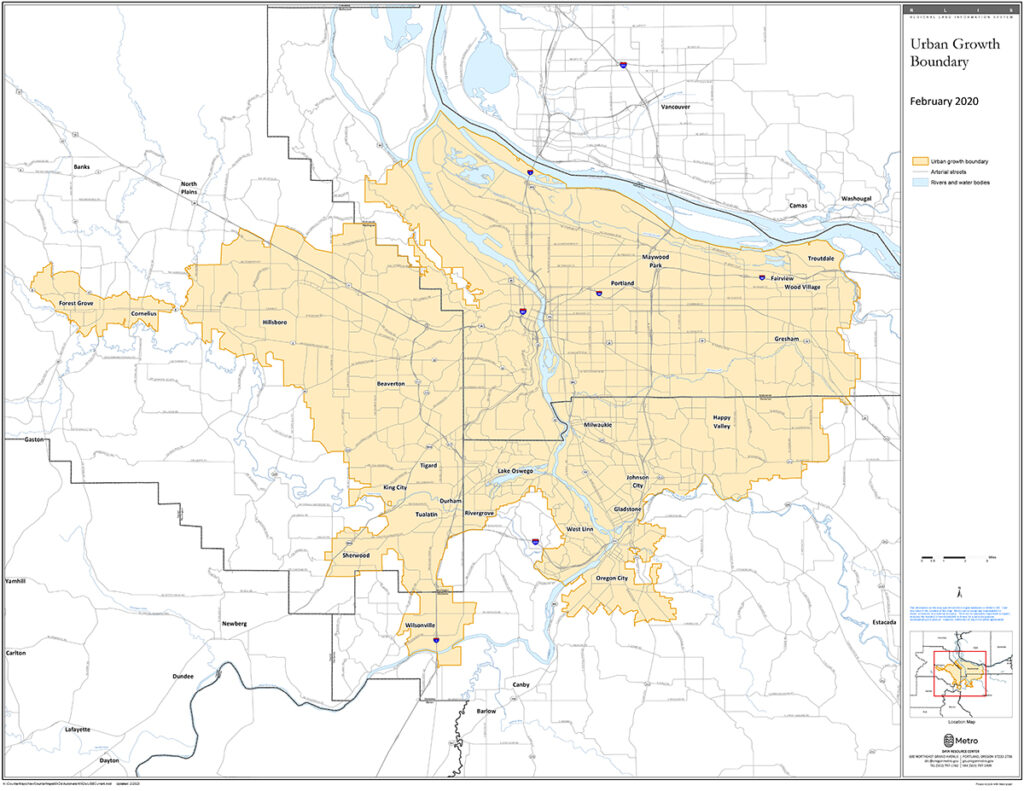
By concentrating development within a defined boundary, communities can make transit and active transportation more convenient by keeping everyday destinations closer together. Clustering development within a defined boundary not only makes active travel more viable, it also improves access to jobs and economic opportunities for people who cannot afford or cannot operate a motor vehicle.
Clackamas County, Oregon’s policy seeks to accommodate growth over a 20-year timeframe within the development zone while prioritizing human as well as local, and state needs. This compact development makes it easier for people to access nearby job centers and amenities, as well as makes it more cost-effective to deliver public services and utilities. Land outside of the development zone is either classified as areas for future growth when the existing urban growth boundary is expanded, or as urban or rural reserves to preserve green spaces and agricultural land uses.
Now we realize that not only is land finite, but also that sites with desirable characteristics for certain types of development are scarce. A growing population is increasing demand for land of all types. It is increasingly important to evaluate characteristics of remaining sites to determine their optimum use.
The Oregon Legislature has provided for land use to be determined at the local level through a rational process of balancing state and local goals, human needs, and the site characteristics of land.
. . .
Urban growth boundaries are designated on the land use plan maps. They separate Urban areas from Urban Reserve areas, Unincorporated Communities, and Rural, Agriculture, and Forest areas. An urban growth boundary encompasses existing urban development and lands to accommodate urban growth forecasted for a 20-year horizon.
Read the full policy here.
go back to Land Use top menu >>
Policy Lever 2-3: Provide density bonuses aligned with community development goals
Traditional zoning codes restrict land use by type, meaning homes are separated by design from jobs, shops, and commercial areas. Zoning codes can also limit the density of places, prohibiting denser, more attainable multi-family housing. One policy tool decision-makers can use to incentivize more of this is the density bonus, which allows developers to build higher or larger places (increasing their profit margins) in exchange for supporting a community’s policy goals, such as providing more housing or commercial space, mixing land uses, or creating or improving public space.
Mixing land uses keeps origins and destinations closer together, which can make it easier to take daily trips on foot, bike, or with assistive devices. Adding in more density can also place more jobs and essential services within reach for those without reliable access to a car.
In Orlando, Florida, the city’s density bonus policy incentivizes developers to bring more entertainment and activity to places that historically only included office buildings and other traditional commercial uses. The city’s policy also encourages a variety of important community amenities, including attainable housing, childcare, and green space in close proximity to job centers.
Density and intensity bonuses implement GMP Future Land Use Objective 1.3 and Policies 1.3.1 and 1.3.2, by discouraging the proliferation of urban sprawl, encouraging a compact urban form, encouraging the redevelopment and renewal of blighted areas, and incentivizing infill development. Density and intensity bonuses also implement Future Land Use Objective 2.4 and Policies 2.1.3, 2.2.5, and 2.4.1, by encouraging a mixture of land uses and a density and intensity of development at or near to the maximum permitted so that public services and facilities can be provided efficiently, while also encouraging mixed-use development, multi-modal transit, pedestrian-oriented amenities, high quality building and site design, affordable housing, and other features that foster livability, community identity, and civic pride.
. . .
Sec. 58.1103. – Criteria for Approval of a Bonus.
A bonus may be granted only when an applicant presents clear and convincing evidence that the proposed design, density, intensity, and mix of uses will result in a superior development that is compatible with the surrounding neighborhood and achieves the criteria for approval provided in this section. To qualify for a bonus, the project must meet the criteria for approval in subsections (a) to (d) below. In addition, the project must meet one or more of the design enhancements provided at section 58.1104, of this Code.
(a)Public goods and services to serve the proposed development must be available, made available by the applicant in proportion to the demand generated by the development, or included in a financially feasible plan.
(b)The development must include space for at least two of the following uses. The secondary use must comprise at least 10% of the building area (except with respect for paragraph 12 below, which has a different minimum area requirement). The secondary use may not be reserved for use only by the principal user (for example, a residents-only gym or an employee cafeteria). The secondary use must be a permitted use or a lawfully allowed conditional use in the zoning district.
1.Multifamily residential
2.Office
3.Light retailing
4.Personal service
5.Eating and drinking
6.Hotel
7.Indoor recreation
8.Public benefit use
9.Child day care center
10.Multifamily residential that has been certified affordable in accordance with the City of Orlando Affordable Housing Certification Process.
11.Live/work units, defined as units that includes a complete dwelling unit with kitchen and bathroom, as well as space suitable for running a business, provided that the business is a permitted or lawfully approved conditional use in the zoning district. To qualify as a live/work unit for the purposes of this part, the live/work unit must be occupied entirely by a single housekeeping unit.
12.In the Downtown Orlando Community Redevelopment Area, publicly accessible open space that is open to the sky and at least 2,500 square feet in area. To ensure that the open space is functional, reasonably contiguous, and consistent with applicable design regulations, the site plan for the open space is subject to review and approval as part of the master plan or planned development zoning application.
13.In the Downtown Orlando Community Redevelopment Area, ground floor space that is suitable for retail uses. For the purposes of this part, “suitable for retail uses” means, at a minimum, ceiling heights of at least 16′, depth of at least 40′, and street facing facades must be at least 30% transparent between 3′ and 7′ above grade.14.In the Downtown Orlando Community Redevelopment Area (specifically that portion located east of Parramore Avenue), conference space/meeting center/ballroom space of at least 20,000 square feet, leasable to the public, with at least one room that can host a minimum of 500 people.
Read the full policy here.
Guadalupe, California’s policy provides density bonuses in exchange for developing attainable housing (five or ten percent of units), senior housing, and for incorporating childcare facilities within or adjacent to the development. Guadalupe specifically recognizes the need to increase the supply of housing for older residents who benefit from living in places where they can walk, roll, or move actively to nearby destinations. Similarly, the city recognizes the importance of providing attainable housing and childcare in close proximity to one another, to support the needs of working families. By providing a density bonus to developers in exchange for including these amenities, Guadalupe is working to create places where key destinations, opportunities, and amenities are located within a short, walkable distance of their most vulnerable older or low-income residents who may not have access to a car.
18.54.010 Purpose.
This Density Bonus Ordinance is intended to provide incentives for the production of affordable housing, senior housing and the development of child care facilities. In enacting this Chapter, it is the intent of the City of Guadalupe to implement the goals, objectives, and policies of the 2015 Housing Element Update and further to implement and be subject to California Government Code Section 65915. In the event that any provision in this chapter conflicts with State law, State law shall control. (Ord. 2016-455 §1)
18.54.050 Eligibility criteria for density bonus.
The City shall consider a density bonus and provide incentives or concessions as described in 18.54.080, when a developer of a housing development seeks and agrees to construct a housing development that will contain at least one of the following:
A. Ten percent of the total units of a housing development strictly for low income households as defined herein;
B. Five percent of the total units of a housing development strictly for very low income households as defined herein;
C. A senior citizen housing development as defined herein;
D. Ten percent of the total dwelling units in a condominium or planned unit development for persons and families of moderate income households as defined herein, provided that all units in the development are offered to the public for purchase. (Ord. 2016-455 §1)
18.54.070 Density bonus for development of childcare facility.
A. A housing development meeting the requirements of Sections 18.54.050 and 18.54.060 above and including a child care facility that will be located on the premises of, as part of, or adjacent to, such a housing development shall receive either of the following:
1. An additional density bonus that is an amount of square feet of residential space that is equal to or greater than the amount of square feet in the child care facility.
2. An additional incentive or concession that contributes significantly to the economic feasibility of the construction of the child care facility.
Read the full policy here.
go back to Land Use top menu >>
Policy lever 2-4: Allow accessory dwelling units
Accessory dwelling units, or ADUs, are secondary residences on the same lot as another home. These might be a physically separated structure, such as a smaller building behind the main residence, or they might be attached to the main house, such as a “granny flat” in the basement or above or in a converted garage. In many zoning codes, ADUs are strictly prohibited; however, revising zoning codes to allow ADUs is becoming increasingly popular across the United States. This is because ADUs have several important benefits, especially for older adults who want to age in place.
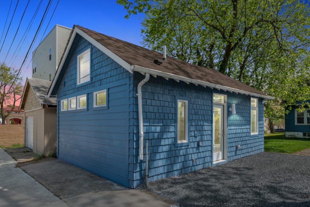
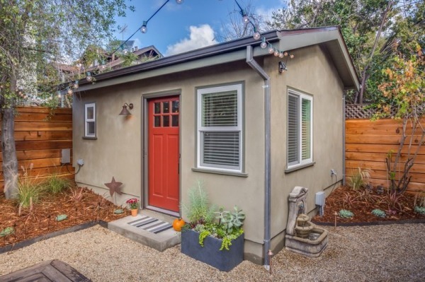
Left, an accessory dwelling unit behind a home in Washington, DC. Photo by WAMU/NPR. Right, an ADU in Oakland, CA. Photo courtesy of the City of Oakland.
First, ADUs increase the affordability and variety of housing choices. This helps to offset the cost of homeownership by providing supplemental income from renting the ADU. Second, ADUs can provide space for an older adult and a caregiver to live very close together but still maintain separate, independent spaces. Finally, ADUs increase the density of housing, which is an important component of creating places that support active mobility as well as makes public transit more viable to operate by increasing the number of people who live near possible transit routes.
Typically ADUs are located in residential places zoned for single-family homes, but increasingly ADUs have also become a part of mixed-use developments. This arrangement is especially beneficial to active mobility, because it brings a variety of trip origins and destinations close together. For example, Menlo Park, California revised its zoning code to allow the construction of ADUs near job centers, transit, and other key resources. This provides affordable housing within a very short trip of everyday destinations, which is especially helpful for lower-income residents who may not have access to a car.
16.79.030 Permitted uses.
(a) Attached or Interior ADUs. Attached or interior ADUs which do not exceed one thousand (1,000) square feet or fifty percent (50%) of an existing primary dwelling, whichever is greater, and have no more than two (2) bedrooms are a permitted use in all zoning districts which allow single-family, multifamily or mixed use which permits residential use.
(b) Detached ADUs. Detached ADUs which do not exceed one thousand (1,000) square feet and have no more than two (2) bedrooms are a permitted use in all zoning districts which allow single-family, multifamily or mixed use which permits residential use.
Read the full policy here.
go back to Land Use top menu >>
Policy lever 2-5: Upzone from single-family to multi-family residences
Zoning codes and policies typically restrict land use types (residential versus commercial) and intensities (one- to two-story buildings versus larger structures). As discussed in 2-3, density bonuses allow landowners and developers to build higher or larger structures in exchange for providing a public benefit. However, providing bonuses on a case-by-case basis one at a time and requiring review for each individual project by city staff can make widespread change much slower and more laborious. In these cases, it can be much more efficient to rezone an entire area to permit greater intensity, opening the door to broader change.
Upzoning policies can designate an area previously zoned for single-family homes to allow multi-family residences, which increases housing variety and affordability, especially near high quality transit. This allows a wider variety of residents to live in a neighborhood and makes transit and active mobility more convenient for everyone.
Upzoning policies are more frequently applied strategically at the neighborhood level, but Minneapolis, Minnesota passed a city-wide upzoning policy, allowing duplexes and triplexes throughout all residential zones, including zones previously reserved for single-family homes. The policy will lead to a dramatic increase in the housing supply across the city while still preserving the character of residential and mixed-use neighborhoods. Minneapolis’s revised zoning code replaces all instances where only single-family zoning was permitted throughout and replaces this with specific guidance and specifications for single, two-, and three- family lots. The revision also removes lot minimums that led to sprawling land use patterns.
521.10. – Establishment of zoning districts. In order to carry out the purposes and provisions of this zoning
ordinance, the city shall be divided into the following zoning districts:
(1) Residence Districts.
R1 Single-family Multiple-family District
R1A Single-family Multiple-family District
R2 Two-family Multiple-family District
R2B Two-family Multiple-family District
R3 Multiple-family District
R4 Multiple-family District
R5 Multiple-family District
R6 Multiple-family District
. . .
546.260. – Purpose. The R1A Single-family Multiple-family District is established to provide for an environment of predominantly low density, single-family single-, two-, and three-family dwellings and cluster developments on lots with a minimum of five thousand (5,000) square feet of lot area per dwelling unit. In addition to residential uses, institutional and public uses and public services and utilities may be allowed.
Read the full policy here.
Goal 3. Built form is human-scale to create comfortable, activity-friendly places
3-1. Plant street trees
3-2. Create first-mile/last-mile connections to transit stations
3-3. Bring buildings closer to the street and require permeable façades
3-4. Provide human-scale lighting
The policy levers described below deal with the edge of the public realm, where the street immediately abuts the adjacent land uses. Ideally this space includes a sidewalk with space not only for people to walk and move actively, but also: street trees to provide shade and separation from traffic, space and street furniture to wait comfortably for public transit, nearby buildings with generous windows to have something to look at as people move along the street, and human-scale lighting to improve safety and visibility at night.
This human-scale built form is often regulated through a policy tool called a form-based code, which is a type of zoning ordinance that dictates the design and orientation of land use and the public realm, rather than the types of uses that can occur there. They help govern how land uses interact with the street rather than focusing on what goes on inside the buildings. (Form-based codes can also regulate land use in lieu of a conventional zoning code, as described under goal 2.) To learn more about form-based codes and explore additional examples, visit the Library of Codes, a searchable database that includes award-winning form-based codes from communities large and small worldwide.
Policy lever 3-1. Plant street trees
Street trees create a more pleasant walking, biking, and active moving experience for almost everyone while also providing numerous safety and environmental benefits. For example, shade from street trees lowers the temperature along sidewalks, which makes active transportation more pleasant and safer for people who might be more susceptible to heat-related fatigue. On a broader scale, street trees along multiple routes in an area can work together to reduce the overall temperature of a neighborhood by preventing the “heat island” effect that occurs when pavement and buildings absorb sunlight. Street trees also provide visual interest for people walking or moving actively along a route, and importantly depending on their placement can also provide physical separation from nearby vehicular traffic.
Billings, Montana’s form-based code requires developers to incorporate sustainable development measures, chosen from several qualifying options. One of these options entails planting street trees specifically with the goal of reducing the local heat island. When assessing proposed projects, Billings evaluates the expected tree canopy at 15-years maturity and assigns points toward the developer’s overall sustainability score.
Sec. 27-1807. Sustainable measures.
(j) Heat island reduction measure (2 points).
(1) Use any combination of the following strategies for thirty-five (35) percent of all
on-site, non-roof hardscape areas, including sidewalks, plazas, courtyards, parking lots, parking structures, and driveways.
a. Tree canopy cover. Coverage of the surface at shade tree maturity in fifteen
(15) years.
b. Solar reflective paving and roofing with a SRI (solar reflectance index) of at
least twenty-nine (29).
(2) Value. This measure earns the applicant two (2) points.
(3) Documentation. Required documentation includes plans and specifications for
installation of the strategy
Read the full policy here.
Babylon, Tennessee’s form-based code includes illustrated design standards for street tree size, spacing, and orientation relative to the street and sidewalks. The code also includes standards for tree sizes at the time of planting.
213-508 Streetscapes
D. Street Trees
(1) Street tree species shall be planted in accordance with the Regulating Plan.
(2) Street trees shall be planted along all streets.
(3) Street trees shall be planted at approximately 40’ or less spacing on both sides of the street and shall be paired across the street, not staggered. TABLE 213-7: Street Tree Species
(4) Street trees shall be 2 ½” caliper minimum at time of planting.
(5) Street trees shall be planted centered in the furnishing zone or centered in the verge.
(6) Street tree planting details shall be consistent with the details contained in the Downtown Wyandanch Straight Path Corridor Area Plan.
Read the full policy here.
go back to Built Form top menu >>
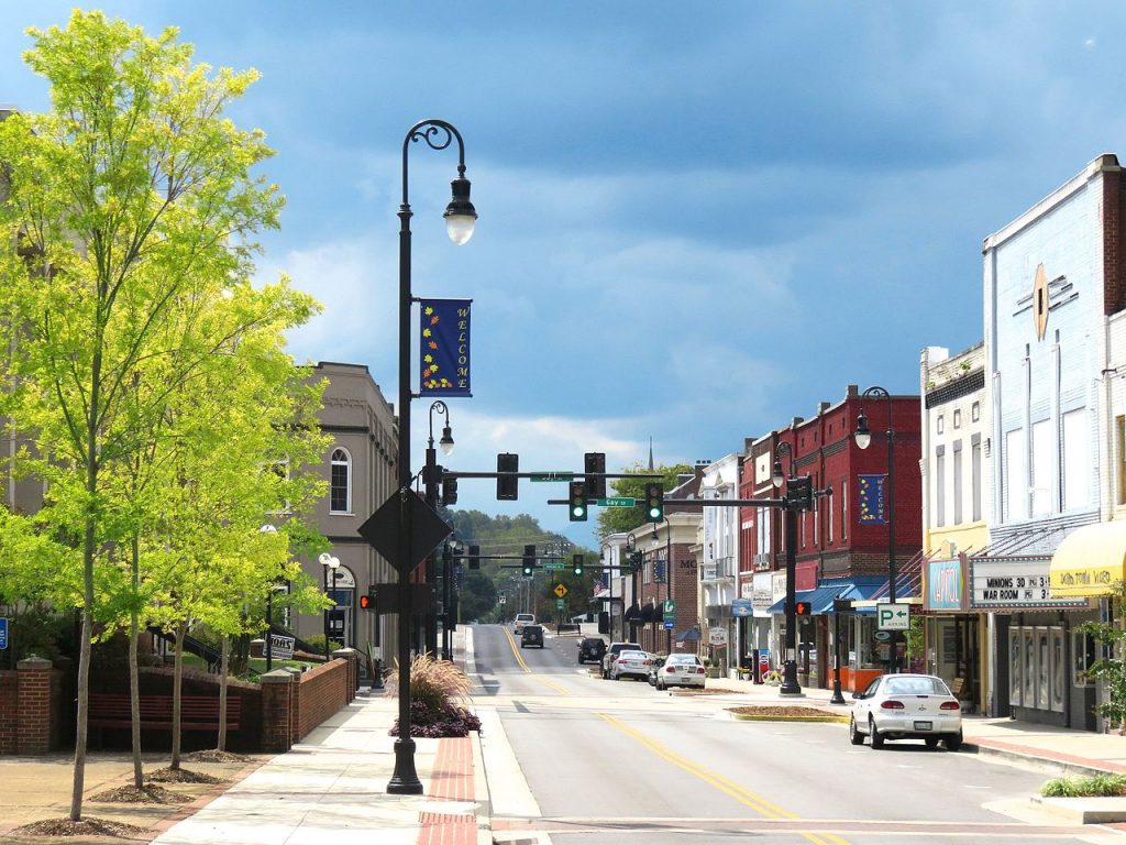
Policy lever 3-2. Create first-mile/last-mile connections to transit stations
Transit trips almost always begin and end with walking or moving actively using an assistive device. Therefore, when decision-makers plan public transit routes, these decisions should not be made in a silo. Instead, to make transit a safe and convenient travel choice, first- and last-mile connections via walking, biking, or moving actively should be incorporated into decision-making processes.
![]()
Establishing activity-friendly routes near transit stops can help to attract new riders as well as improve safety, convenience, and accessibility for people who are already using or relying on transit in a community, including people who cannot afford or cannot operate a personal vehicle due to income, age, or disability status.
Thompson’s Station, Tennessee prioritizes transit, cycling, and walking together in its land development ordinance. This comprehensive approach recognizes that these modes are interconnected, and that many trips include a combination of modes. The code designates specific transit routes where bus pull-outs and shelters are required, to make the process of waiting for, boarding, and disembarking the bus more pleasant. Additionally, this code designates “pedestrian sheds” which are areas with a radius of quarter-mile (or a five-minute walk) where key amenities are located, including public transit. By approaching planning in this way, Lacey ensures that amenities such as bus stops and parks are easily accessible within a short active trip.
1.2.11 Health and safety
f. The transportation system should enable and prioritize mobility by transit, cars, bicycles and pedestrian modes as appropriate to each zoning district. These modes shall have priority over vehicle dominant strategies when considering design, operations or maintenance of the public Thoroughfares;
. . .
2.2.4 Mixed-use Community Types, Design.
b. Structure and placement of a pedestrian shed. A pedestrian shed is a notional circle with a radius of 1/4th mile. Each pedestrian shed is placed on the site of a community type. The pedestrian shed should be located according to existing conditions, such as traffic intersections, adjacent developments, transit stations, and natural features.
. . .
3.5 Civic and Open Space Standards
b. Each pedestrian shed shall contain at least one main civic space that is a green, square or plaza per Table 3.1 Civic Space Types. An entrance to the main civic space shall be within 800 feet of the center point of the pedestrian shed, unless topographic conditions, pre-existing thoroughfare alignments, or other circumstances prevent such location.
Read the full policy here.
go back to Built Form top menu >>
Policy lever 3-3. Bring buildings closer to the street and require permeable façades
The places most conducive to walking and active mobility often feature businesses and housing where entrances and windows face the street, and where buildings are located very close to the sidewalk—rather than far away beyond a sea of parking. Orienting buildings in this way creates a more vibrant, attractive active mobility experience with plenty to look at, which can make trips seem shorter.
Where would you want to walk? People walking or moving actively seek out streets that have windows and interesting storefronts to look at and avoid streets with plain, boring blank walls.
Additionally locating buildings close to the street carries an important safety benefit: the sense of enclosure created is not only more pleasant for people walking and moving actively, it also cues drivers to be aware of their surroundings and proceed more slowly.
Birmingham, Alabama’s form-based code establishes zero foot setbacks in certain zones for residential and business uses to create more vibrant places to walk and move actively. (Zero-foot setbacks require buildings to meet the edge of the public space with zero separation, i.e, the way that buildings are typically built in the core of cities and towns of all sizes, right to the edge of the sidewalk.) The code also requires buildings to have easily accessible entrances from the sidewalk as well as permeable facades to provide a visually interesting experience for people moving actively along the street.
Subsection 7. Building Form Requirements
A. Entries:
A principal building shall have its main entrance oriented to a public street and accessible from a public sidewalk or plaza. Secondary entrances are exempt from this requirement. The main entrance shall not be closed while a secondary entrance remains opened.
. . .
B. Facades:
1. Window and door openings should have a vertical orientation and vertical alignment between floors.
2. All forecourt, gallery and shopfront frontage categories may be designed with a discernible base, middle and cap defined by horizontal elements. An expression line should accentuate the base from elements above. Variations in materials and colors can help achieve this standard.
3. For mixed-use and non-residential buildings, ground-floor front facades shall be not less than 40 percent or more than 90 percent clear glazing; measured between 3 and 8 feet from finished grade. Additional floors beyond the ground floor shall be not less than 25 percent or more than 75 percent clear glazing.
Read the full policy here.
go back to Built Form top menu >>
Policy lever 3-4. Provide human-scale lighting
Committing to activity-friendly routes to everyday destinations means providing safe, comfortable space for people to walk and move actively regardless of the time of day. Providing human-scale lighting is an important step to support active mobility during dawn, dusk, and overnight hours, by ensuring people can see their surroundings and can be seen by motorists.
Traditional street lighting, akin to the lighting along a busy highway, is designed primarily to help motorists see the road and other vehicles around them, and is not designed to serve the needs of creating activity-friendly routes. This is because the excessive height and spacing creates shadows that make it harder for people to clearly see what’s around them, as well as make it more difficult for motorists to see people who are walking or moving actively along or across the street. This is especially important for people who may work night shifts such as in the service industry, as well as for people who do not have access to a car and who therefore may need to navigate on foot or with assistive devices at all hours of the day.
Arlington, Virginia’s form-based code for the Columbia Pike corridor requires developers to install street lighting as part of transportation improvements, to ensure those walking, driving, and moving actively with assistive devices can all see and be seen.
3. STREETSCAPE
B. STREET LIGHTS shall be installed on both sides of STREETS along the STREET TREE ALIGNMENT LINE and unless otherwise designated on the REGULATING PLAN, at no more than 60 foot intervals measured parallel to the STREET.
Read the full policy here.