


News
By Helen Hope, August 25, 2021
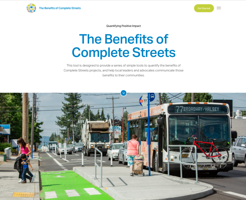
Today, the National Complete Streets Coalition and Smart Growth America are launching a new site to help local communities better model and evaluate the potential benefits of Complete Streets projects—measuring and proving their many economic, health, environmental, equity, and safety benefits—without ever turning over a shovel.
Our brand new Benefits of Complete Streets site and tool is going live to the public today, allowing a local community to quantify the benefits of Complete Streets projects, which can equip and arm local leaders and advocates to make these projects more likely by clearly communicating the benefits to their communities.
While the tool also measures other important benefits, the economic angle here is one more way we are making the economic case for a different way to grow. Our economic development team helped build this tool—read more about why economic development is a fundamental part of smart growth with our summer of ongoing content here.
Smart Growth America partnered with the Centers for Disease Control and Prevention’s Division of Nutrition, Physical Activity, and Obesity to build this tool, which is designed to measure the benefits of building Activity-Friendly Routes to Everyday Destinations through Complete Streets. These efforts are part of the Active People, Healthy Nation InitiativeSM that is working to help 27 million Americans become more physically active by 2027.
This new data-driven tool can help measure and project the benefits across four impact categories of health, safety, environment, and economy—using an approach that keeps equity at the center.
The resulting data can demonstrate the benefits of a specific Complete Streets project in local communities, like a site-level intervention such as the reconfiguration of an intersection, or a corridor-level intervention like installing bike lanes, shade trees, or widening pedestrian space.
The four areas that we measure
- Environment: When we make walking, biking, rolling, moving actively with an assistive device, and riding public transit safer, more convenient, and more accessible, people are more likely to choose these lower-emission options instead of driving alone.
- Health: The health benefits of physical activity are incredibly important and broad-reaching. Complete Streets can provide more opportunities for physical activity as part of people’s daily routines.
- Safety: To reverse the alarming trend of people struck and killed while walking we must protect all users of the transportation system through policies, programs, and funding. A Complete Streets approach designs roads for all users, slows cars, and prevents crashes that can cause death or disability.
- Economic: Our Safer Streets, Stronger Economies report showed that Complete Streets not only reduce crashes and injuries but boost employment levels, property values, investment from the private sector, and net new businesses.
The tool considers all four of these areas with an equity approach
To better understand who might benefit from a potential Complete Streets project, the tool uses comparison data to help you determine if the project supports your specific community’s equity efforts.
Some communities have already used this tool
If you’re having a hard time envisioning the tool in action, read this short story about one community’s experience with it. RAO Community Health, a nonprofit in Charlotte, used the tool to measure specific interventions on a corridor where safety is poor, access is low, and modest improvements to street design can bring big benefits. What did they find?
Recognizing the challenges and the potential of the corridor, a road diet project is already underway on Parkwood Avenue, led by the City of Charlotte. But even with that important project in progress, RAO and Sustain Charlotte were able to use this Measuring the Benefits of Complete Streets Tool to predict the impacts that the new street design would have on residents in the area, including measures that would affect people’s safety, health, the environment, and the local economy.
Among other benefits, the tool showed a 75 percent reduction in fatalities, a 29 point increase in the Walk Score of the project area, reductions in major diseases among those who begin walking or biking more, and a projected tax base increase in the tax base over 20 years, providing which could provide more financial support for producing or preserving new affordable housing in the area. Read their full story here.
How to use the new tool
If you’re interested in using the new tool, simply go explore the site to learn more, and then request the tool here (which will arrive in your inbox) with a short user guide to help you out. Any questions about the tool specifically? You can get in touch with us here.
Modest data skills are required
To use the tool in its entirety, some knowledge of data sources and GIS analysis is required, but it was designed by our team of researchers and technical experts to be accessible and generalizable for communities across the country, and draws from data sources that are generally easy to access and interpret.
Related News


Livable places. Healthy people. Shared prosperity.


© 2026 Smart Growth America. All rights reserved
Site By3Lane Marketing
