


News
By Smart Growth America, October 22, 2015

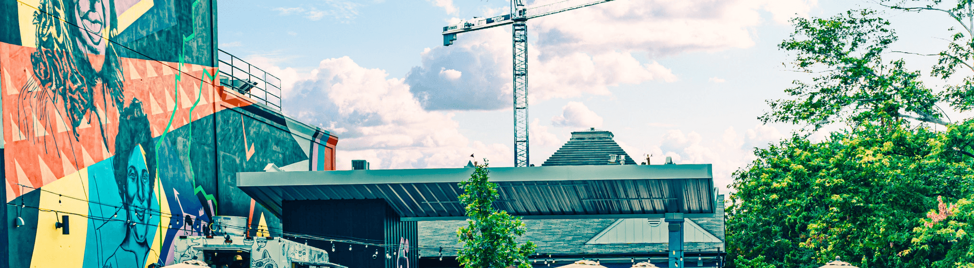
Seattle's chief road engineer Dongho Chang, next to Broadway's new protected bike lane. Photo via the Green Lane Project on Facebook.
When activists painted a guerrilla bike lane in Seattle, they didn't expect a traffic engineer to thank them. But that's what Seattle traffic engineer Dongho Chang did, commending for bringing attention to the safety issue — and then installing a more permanent treatment soon after. Chang spoke with the National Complete Streets Coalition about a few of the Seattle Department of Transportation’s signature projects, the inspiration for his work, and what he’s learned in 25 years of traffic engineering.
National Complete Streets Coalition: Tell us a little bit about yourself, what drew you to this work?
I grew up in a suburban area of Seattle and Tacoma, and went to college at the University of Washington, which is in a very urban area. My college counselor took me downtown to show me what a big city looks like, and I was just blown away by the vibrancy, density, and the huge skyscrapers. I was primarily interested in civil engineering, and interested in transportation, but then I had this amazing professor, Fred Mannering, who just loved the topic. I think every student that was in his class was infected by his enthusiasm. I wanted to do what I could to improve our ability to function as a society and to be really thoughtful about our impact to the environment.
How did you first start to use Complete Streets approaches?
Most of my career was working at the state Department of Transportation. I worked there for almost 16 years. The agency was cutting-edge in how the organization functioned and the things that they did with the existing infrastructure, but the mission was really about moving vehicles on highways and interstates. I saw the consequences of making things more efficient. Solving the congestion problem made it worse because it allowed more development to occur.
I was interested in how to influence policymakers to make better decisions. I got a masters degree in public administration, but I quickly realized that the agency that I was working for did not include influencing policy in its mission in any way. I wound up working for a smaller city, the City of Everett, as a traffic engineer. Everett is an amazing city. It had a comprehensive understanding of how land use, water, and transit service providers can work together. It was a great city to work for, but my heart was in Seattle. An opportunity came up at Seattle’s Department of Transportation, so I applied, and I am very fortunate to be here.
It’s an incredible time to be in Seattle. There’s amazing opportunity, and our population is growing by leaps and bounds. In the last ten years, we’ve grown by 11%, but people are driving less and traffic volumes have decreased in that time by 10%. Transit ridership has risen by 40%. We’re so constrained by our geography, but people are biking and really allowing our economy to grow by taking the bus.
What would you consider the hallmarks of your community’s Complete Streets initiative?
Almost a third of Seattle’s land mass is city public right-of-way, or streets. We’re the largest property owners in the city!
There was a recognition there wasn’t enough gathering space to meet our growing needs, so the community voted for a levy to require acquire more space. If you think about purchasing property downtown, park space is a very, very expensive proposition, and would probably take up the entire levy. So we tried to come up with an innovative approach. In partnership with Seattle’s Parks and Recreation department, we created a flexible street along a four-block parcel called Bell Street Boulevard Park. The community along Bell Street had already identified a need for a gathering space.
There are some streets that can still handle the necessary traffic volumes, but can be repurposed and have a different feel. We created a 10-foot travel lane that meanders through these four blocks; it was really just a texture and color change. The space is curb-less, except for areas where we created curb bump-outs that protect the plants. We signed a memorandum of agreement so that the Parks and Recreation Department maintains the greenery in the space, that’s what they do well.
When the project was under development, there was a lot of discussion between the Transportation and Parks and Recreation Departments about how to create this environment where the street still functions, but really signals to the public that this is a different street. There was a lot of discomfort initially.
The Bell Street project was hugely successful. In the first year that it was open, we had no collisions. People are driving at 20 miles per hour. We’d like them to go a little slower, but that’s the ideal speed for a lot of our neighborhood greenways. Our traffic volumes went from 5,800 vehicles per day to right around 2,000. We still carry buses through that corridor. If you visit it, it’s pretty comfortable for a person who’s walking and sitting down and enjoying the space.
People come and see that, wow, things that are very minor in terms how a roadway is designed can have a significant impact on the psychology and behavior of the people who are walking, driving, and living on the street. We hear that that this is something that people want more of. People don’t want streets that are intimidating.
In the long-term it would be great to have Bell Street expanded and reduce the traffic volume down to 1,500 — that’s closer to our threshold for neighborhood greenways.

Seattle's Bell Street. Photo courtesy of SvR Design Co.
If you were starting the project today, what would you have done differently?
We would do a bit more aggressive traffic calming. Even with the existing 10-foot lane, we would narrow that down even more since there are other routes available. If you engineer for the behavior that you want, that’s what you’re going to get. If you don’t, then you suffer the consequences of that, and you’ll need to do additional treatments afterwards. It comes from a partnership of all the stakeholders and coming to the conclusion that we want to develop the conditions that will achieve the behavior that you want on the street. That’s what we’re learning as we refine our methods.
What are you excited about in the next year?
We’ll be tackling one of our most challenging corridors this year, Rainier Avenue. Stay tuned, because it such an amazing community that has suffered for a long time and have been very rightly concerned about what’s been happening along the corridor. We are now at a point where we’re going to really try to change small sections at a time, show what can be done, and then change the entire corridor.
Rainier Avenue was a state highway, and the community developed around it, but the corridor hasn’t changed. It’s a long corridor that connects from Renton to Seattle and parallels Interstate 5. There are more than 70,000 people living along the corridor, as well as 10 schools, 11 industrial parks, a lot of senior housing, and two libraries. The traffic volumes are range from 19,700 to 26,000 vehicles per day on different sections of the street. It has one of most high ridership bus routes in the city. Eleven thousand people ride the bus every day, which is almost half the traffic volume on that street. Those are people who are crossing the street at least once to get to the bus.
Rainier Avenue is critically important for us because Southeast Seattle, which Rainier Avenue serves, tends to be a very diverse community. As we do the community engagement we are hearing that this community has been suffering from the collisions along the corridor, and have not, for a lot of reasons, been as vocal as other communities that we historically interact with. On average, we see a crash a day along that corridor. In the last three years, we saw almost 1,200 collisions and 630 injuries. In the last ten years, there have been 11 fatalities. It is our highest collision corridor in the city. All the collision data on that street tells us is that the behavior on the street is because of the street design. There is one particular intersection that had 22 left-turn collisions. It’s a pretty predictable pattern. There are 1,800 high-end speeders, people who going 10 miles per hour over the speed limit on the corridor per day.
We’ve had lots of great input so far. In our community engagement we also heard very clearly that people want to be on that street on their bikes. That route is a very flat route If you take a local side street, it’s very difficult because it’s a valley and there are terrain challenges and connectivity issues. In the past because of the sheer volume of traffic, it has not been identified as a bicycle corridor.
We are doing detailed traffic modeling and micro-simulation of transit performance. We are looking at reconfiguring from a 4-lane to a 3-lane to reduce the traffic volume and improve safety. We want to make sure people can use transit. We also want to make the vitality of the business core even better. Our experience with traffic volumes over 26,000 is that, even with the new lane configuration, the traffic volumes will stay the same while also improving safety. We’ll be going back to the community in the next month or so with the results of our analysis. Our goal is to have safety improvements in this summer. For the location with the left-turn lane problems, it could be as simple as instating no left-turn lanes in peak hours. I’m so excited to be working in Seattle now, these concerns have been in place for a long time.

Rainier Avenue. Photo by Oran Viriyincy via Flickr.
What other partnerships have been helpful for you in your work?
Our fire department is amazing, and they work with us on all of these very unique projects that in most jurisdictions would make emergency response very uneasy. They understand the need for having a good community space so they work with us.
Neighborhood Greenways is an amazing, amazing non-profit. They are people living in the community that are focused on the residential streets. They work closely with us to help us understand the needs and barriers. The membership lives in the community. They tell us where people want to cross but are afraid to, which helps us prioritize projects that staff may not know about. We also work very closely with the Cascade Bicycle Club, which is an advocacy group with a more regional focus, they tell us about the bike needs.
Bike Works, which is located in Rainier Valley, is a non-profit that teaches kids to work with bikes and earn their own bike. They have been very, very helpful in our understanding what the needs are for kids who want to ride their bikes. Seattle has neighborhood councils, and we have been presenting there, and at the Columbia City and Hillman City Chambers of Commerce. We also work with large agencies and organizations such as Metro Transit, our service provider for the bus system, and the Freight Advisory Board. We also hear from individuals who are homeowners or business owners.
Is there anything that you’ve learned in your work that you’d like to share?
These issues and solutions don’t need to cost a lot of money. With a robust data review and analysis you can have a major impact with almost no cost. If you have a location that has a lot of people crossing, a simple as a leading pedestrian interval gets people into the intersection first so that they have a chance to cross. What does that cost? Not much at all. As transportation professionals, we are learning more and more that we need to have a much more balanced approach and that we need to look out for the most vulnerable users.
What design challenges are you seeing in Seattle?
One challenge, which we are seeing more and more in these multimodal corridors, is that all the modes want to be on the same street. And sometimes certain streets may not be able to handle all the modes. Seattle’s 23rd Avenue is a good example: it’s a north-south corridor that’s next to Rainier Avenue. It’s one of those corridors that we identified as a transit corridor, that’s also high-need pedestrian, high-need biking, and high-need freight. We had sections with 2- foot and 3-foot sidewalks, which was not conducive to transit. People that live on the street didn’t let their kids out of their sight.
We are bumping out the curb to allow for more transit space because we needed to ensure that transit function, so that it’s really a people space. There wasn’t any room there for bikes, so we created a parallel route on a residential street. If you’re a confident bicycle rider you can still use that street, it’s much more calmer than before. If you’re a more timid rider, you can still be on the sidewalk, since Seattle permits riding on sidewalks. So there’s still access, but there’s also a parallel route that you can take that is very low speed and low volume and that takes people to where they want to go. So that’s an example of where we needed to make that trade-off, and I think we made the right choice.
Has having children changed how you see your work?
All of us as community members change focus when we become parents. I have two young kids. I want their experience to be just as rich as mine. When I was going through school I had the chance to experience our beautiful Northwest: hiking and going camping and visiting our national park, Mount Rainier. Those glaciers that were just majestic are not there anymore. Those amazing and breathtaking views are totally different. I’ve seen that change just in my lifetime.
I think sustainability is really important. I will definitely do my part to help my community and society minimize our impact to our earth. I want to make sure that my kids have opportunities as they grow — that housing is affordable, that they have educational opportunities. Transportation is a huge cost to a family—just think about the resources that are freed by allowing a family to get around without owning a car. I know every family is different, but allowing that choice means creating a city that also works for more people.
Sometimes we see our fragile transportation network break down, which has huge consequences for people. As a father, I experience that when I am picking up my kids, so I want to make our system resilient and robust, and allow people choices so that they have a rich life and they don’t have to worry about sitting in traffic.
What keeps you inspired?
It’s the feedback from the community on the projects that we do. The Northeast 75th Street project is an example of one where we did it very quickly after a horrific crash. It took the lives of two grandparents. The baby in the crash had to be resuscitated and the mother was permanently injured. There was a lot of negative reaction during the entire process. People didn’t want any changes. They said, “The street is fine, it’s been that way forever.”
After we did the change, the data showed that the street actually carried more traffic volume than before, and that travel through the corridor was faster because of the lack of conflicts. A survey in the community showed that a majority of the people liked the change. When I go out to the community, I still hear from people that it was the wrong decision, but if I show the data, they come around very quickly. Even with a negative reaction, you can show people the data and show how things have changed, and you can change minds.
It’s very rewarding to change that paradigm from “no, no, no” to “oh, maybe that was a good change” and have that person be an advocate for other changes. That’s how we create change and promote sustainability in our city.
Learn more:
- DONGHO CHANG: Coolest Traffic Engineer Ever, davidbruceblog
- Peter Hahn & Dongho Chang: A Legacy of Seattle Neighborhood Greenways, Seattle Neighborhood Greenways
- Bell Street Park Parks and Green Spaces Levy Project Information, Seattle Parks and Recreation
- Road diet; aims to make Rainier Ave. slimmer, slower, safer, Seattle Times
- Barbara Gray, Seattle Department of Transportation, presentation for Safer Streets, Stronger Economies webinar, Smart Growth America
This case study was written by Hanna Kite.
Related News


Livable places. Healthy people. Shared prosperity.


© 2026 Smart Growth America. All rights reserved
Site By3Lane Marketing
